
Arab Canada News – News for the Arab Community in Canada
News
«El Niño» is heading towards an exceptional level.. What does that mean for the weather in Canada?
High probability of the phenomenon reaching a very strong category during autumn, amid expectations of a warmer winter in the west and central parts of the country and concerns about drought,
Published: July 19, 2026
The waters of the tropical Pacific Ocean are witnessing a rapid rise in temperatures, indicating the development of the "El Niño" phenomenon, which climate experts expect to become one of the strongest phenomena recorded since the beginning of modern monitoring.
The U.S. National Oceanic and Atmospheric Administration announced that "El Niño" is already in effect and is expected to continue intensifying throughout the remainder of the year, with a 97% chance of persisting until early spring 2027.
Current estimates indicate an 81% probability that the phenomenon will reach a "very strong" level between October and December, which could place it among the largest recorded "El Niño" events since 1950.
However, climate scientists emphasize that the term "Super El Niño" is used in the media and is not an official classification. Scientific bodies classify the phenomenon starting from weak and moderate, then strong and very strong.
Also, the strength of the phenomenon does not automatically mean that every region will experience the usual climatic effects, as it interacts with other factors, including air currents, Atlantic Ocean temperatures, the Arctic, and climate change.
What is the El Niño phenomenon?
"El Niño" occurs when sea surface temperatures in the central and eastern tropical Pacific Ocean rise above their normal levels for an extended period.
This warming leads to changes in the locations of clouds and storms over the ocean, then its effects extend to air currents, storm paths, and patterns of heat and rainfall worldwide.
The phenomenon usually appears every two to seven years and often lasts between nine months and a year, with its peak impact typically between November and February.
The latest weekly measurement in the "Nino 3.4" region, the primary area used to monitor the phenomenon, reached about 1.2 degrees Celsius above the normal average, with expectations of continued rise in the coming months.
International models indicate the possibility of seasonal warming exceeding two degrees Celsius in key areas of the Pacific Ocean, a threshold usually associated with very strong events.
What does this mean for Canada?
Canada is more clearly affected by the "El Niño" phenomenon during the winter and spring seasons, not necessarily immediately when ocean temperatures rise in the summer.
Historically, the phenomenon is associated with warmer-than-usual winters in western and northwestern Canada, parts of the Prairies, and central Canada.
The most affected areas may include British Columbia, Alberta, Saskatchewan, Manitoba, and Yukon, in addition to parts of Ontario.
Forecasts do not mean that cold waves will disappear or that all winter days will be warm; rather, the average temperatures during the season may be higher than normal.
Periods of severe cold and snowstorms may still occur, even during a winter dominated by a strong phenomenon.
Less snow and a shorter winter season
Warmer weather can reduce the amount of precipitation falling as snow, especially in the southern and western parts of the country.
This may lead to less snow accumulation and earlier snowmelt in spring, with potential impacts on ski resorts, rivers, reservoirs, and water supplies used in agriculture and hydroelectric power.
However, the effect of "El Niño" on rainfall and snowfall amounts is more complex than its effect on temperatures, and some areas may experience precipitation close to or above average despite a warm winter.
Cities may also receive mixed precipitation of rain, snow, and ice instead of continuous snow, increasing the risks of slippery roads and freezing rain.
The Canadian East is less affected
The connection between "El Niño" and weather is usually less clear in eastern Canada, including Quebec and the Atlantic provinces.
These areas may be influenced by other stronger climatic factors than the Pacific Ocean, such as the North Atlantic Oscillation, jet stream paths, and Atlantic Ocean temperatures.
Therefore, "El Niño" alone cannot be considered a reliable indicator of winter conditions in Montreal, New Brunswick, Nova Scotia, or Newfoundland and Labrador.
These regions may experience a warm, stormy, or variable winter, depending on the interaction of several weather systems during the season.
What about Ontario, Toronto, and Ottawa?
"El Niño" may push average temperatures in Ontario to higher-than-usual levels, especially during the first half of winter.
This may lead to longer periods above freezing, more rain or mixed precipitation, and shorter snow cover duration in southern Ontario.
However, cities near the Great Lakes remain vulnerable to heavy snowstorms because the warm, open waters of the lakes can enhance snowfall when cold air masses pass over them.
Thus, winter may be warmer on average but still experience short, intense storms and sharp fluctuations between warmth and cold.
Drought and wildfires
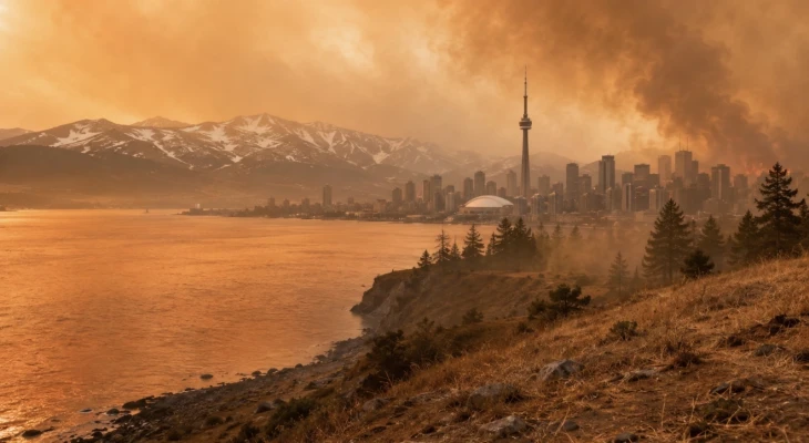
The intensification of "El Niño" raises concerns about its impact on soil moisture and snow cover during winter, and the potential consequences for the upcoming fire season.
Warm winters and reduced or early melting snow can leave forests and grasses drier at the start of spring, especially in areas already suffering from rainfall deficits or accumulated dryness.
Fire risks may increase when these conditions coincide with high temperatures, strong winds, and prolonged dry spells.
However, "El Niño" does not directly ignite fires and cannot be held responsible for an entire fire season, as risks also depend on lightning, human activity, winds, rainfall amounts, soil moisture, and the speed of fire response.
Climate change also raises the overall risk background by increasing the frequency of extreme heat, lengthening the fire season, and accelerating vegetation drying.
Does it explain the current heatwave and smoke?
A specific heatwave or fire cannot be attributed solely to "El Niño."
The phenomenon changes general probabilities and weather patterns over wide areas and long periods but does not act as a direct cause for every hot day, storm, or fire.
The phenomenon is still developing, and its impact on Canada is expected to become clearer during fall and winter compared to the current summer months.
Nevertheless, Canadian authorities say the transition to "El Niño" may affect fire risks and air quality, especially if it later contributes to sustained heat, drought, or reduced snow cover.
Possible decline in Atlantic hurricane activity
The intensification of "El Niño" may increase strong winds in the upper atmosphere over the Atlantic Ocean, conditions that usually inhibit the growth of tropical storms and their development into major hurricanes.
This may reduce the number or intensity of Atlantic hurricanes, but it does not eliminate the risk entirely.
One strong storm reaching the Canadian Atlantic coast is enough to cause widespread damage, even if the total number of hurricanes during the season is below average.
Not every El Niño winter is the same
The "El Niño" phenomenon is an important factor in seasonal forecasting but is not a daily forecast or a precise map of what will happen in every city.
The winter of 2015–2016, during one of the strongest previous events, recorded temperatures higher than usual by between one and five degrees Celsius across various Canadian provinces, with exceptional warmth in Quebec, central Prairies, and Yukon.
However, other strong events produced different patterns due to variations in the location of ocean warming, timing of peak intensity, and interaction with other climatic systems.
Therefore, Canadians will need to wait for updated seasonal forecasts in the fall to get a clearer picture regarding temperatures, rainfall, and snowfall in each region.
Until then, indicators suggest Canada is heading toward a winter that may be warmer and more variable across wide areas, with potential impacts on snow cover, water, agriculture, energy, and the subsequent fire season, but without a guarantee that the same scenario will occur throughout the country.














Monday, 20 July 2026
Loading...
--°C
--°C
- --%
- -- kmh
- --%